Monday, October 17, 2011

#116 Pavlos-Petros Peaks. Idaho Summits 2011 Fall Outing

Summit of Pavlos comes into view above tree line.

The Idahosummits.com Fall Outing participants converged on Christian Gulch in the Pashimeroi Mountain range on October 2, 2011 for an outing objective of Pavlos Peak, (11,109 ft) a Class 2/3 climb. For those that wanted a mountain 2-fer, there was an option to continue an additional mile to Petros Peak (11,060 ft), a Class 3/4 climb.

Most of my Pocatello mountaineering friends had low to non-existent climbing seasons this year as a result of other commitments and/or injuries, so I prepared to meet up with the Idaho Summits group on my own. Being adverse to uber-early drives from Pocatello to unfamiliar back-country destinations, I decided to camp at Christian Gulch the night before.

Leslie, George and Sean in camp.
I thought I left early enough, but I never seem to plan for overshooting my turnoff, which of course I did in my haste to beat nightfall. After a 30 minute side trip, I was back on course. After a half hour on washboarded gravel road, I was pleasantly surprised, in the middle of nowhere, to see a red truck I didn't recognize, with a driver, I didn't recognize, who stuck his arm out his window and waved me toward him. "Anywhere else, this would be a huge mistake," I said to myself as I proceeded my little Versa toward his truck. In the meantime, he stepped out of the vehicle and came toward my side window, which I had rolled down. "Hi Margo, I'm George (Reinier, an Idahosummits.com message board regular)." (Sigh of relief) "Hi...great to meet you George." As my odometer indicated I had two more miles to go before turning off, it was convenient that George decided to be the outing greeter. If he hadn't been, I would probably still be driving around out there.

Sean, Leslie, Margo, Dave, Alex, Steve, John, Dylan
George and Eric (photo by Dan Robbins)
George was concerned that I might not be able to get my commute-practical car all the way to camp, so he lead the way, waiting at any moment for the "I-give-up" flash of my headlights. It was pretty rugged for low clearance, but the headlight flash never came, as I made it there by dancing back and forth across the lane, dodging big rocks, ruts and gravel piles. By the time we made camp, the intermittent sprinkles that started when I met him had turned into a light rain.

At camp, I met Sean (Duffy), another message board regular, and a friend of his, Leslie Fairbrother, from Hailey, who arrived 15 minutes or so before me (George had greeted them at the trailhead too). Initially, there was no real time for pleasantries as we all were busy getting tents up and food down, pretty much in that order. Regarding tents up, you always hear to assemble a new tent yourself before taking it out in the back country. I can report that "seeing" it assembled in your front room is no substitute for the actual hands-on activity. I asked George to help me with the tent on my second attempt when the rain had died down a bit.

SummitGirl enjoying the crux.
By popular request, Delta (Steve Weston) had made dinner for the campers but he didn't know if he was going to make it in all the way to camp that night to cook it for us himself. So earlier that day, Delta had taken his Tuscan Stew over to George's house to bring out for us. George took care of heating up dinner too. (And, it was AWESOME!!) Now, the rain is coming down quite steadily as the four of us huddled under a pine tree, eating dinner, and staring at the fire in the fire pit about six feet from us. Then George says, "I have a gazebo we can put up." I quickly wondered how we ever had an Idaho Summits outing without this guy before? So the four of us spent the rest of the night under the gazebo, next to the fire, getting to know each other as the rain finally subsided and the clouds parted to a stunning starry night.

The next morning, Eric Larsen showed up from Idaho Falls before the 8 a.m. original start time. Dave and Alex Pacioretty drove in not too long after. Alex was on his second day of leave after completing boot camp in Oklahoma, having just flown into Salt Lake City the morning before. He was ready for some mountains. Dan Robbins had picked up Delta outside of Craters of the Moon, where Delta had spent the night in the car, and John and Dylan Fagden finally made it in from Boise. Dylan had all of a couple hours sleep, having gone to his homecoming dance the night before. A pretty dedicated team I would say....
 
Petros from Pavlos summit.
Our trip itself is well described by both Dan's and the Fadgen's trip reports. Here is my video from the summit of Pavlos (turn the volume down...it's just wind). With the multitude of reports coming out from various outing participants, I have no longer tried to put a different twist to the narrative, and instead have taken to making a photo video from pictures my team members send to me. It took me a little longer than usual to finish this particular video, as I had been looking for the "perfect" song. I think I nailed it...it fits the characteristics and landscape of this trip, and it eludes to a (now) inside joke, having nothing to do with me by the way.

It was great to climb again with old and new friends. I am forever grateful and pleased to know these truly wonderful people and am thankful they let me join them to enjoy the rugged back-country of Idaho. Climb On!

SummitGirl on Pavlos

Sunday, August 21, 2011

#112, North Twin Peak, #113 Red Cone Peak, Lost River Range, Idaho

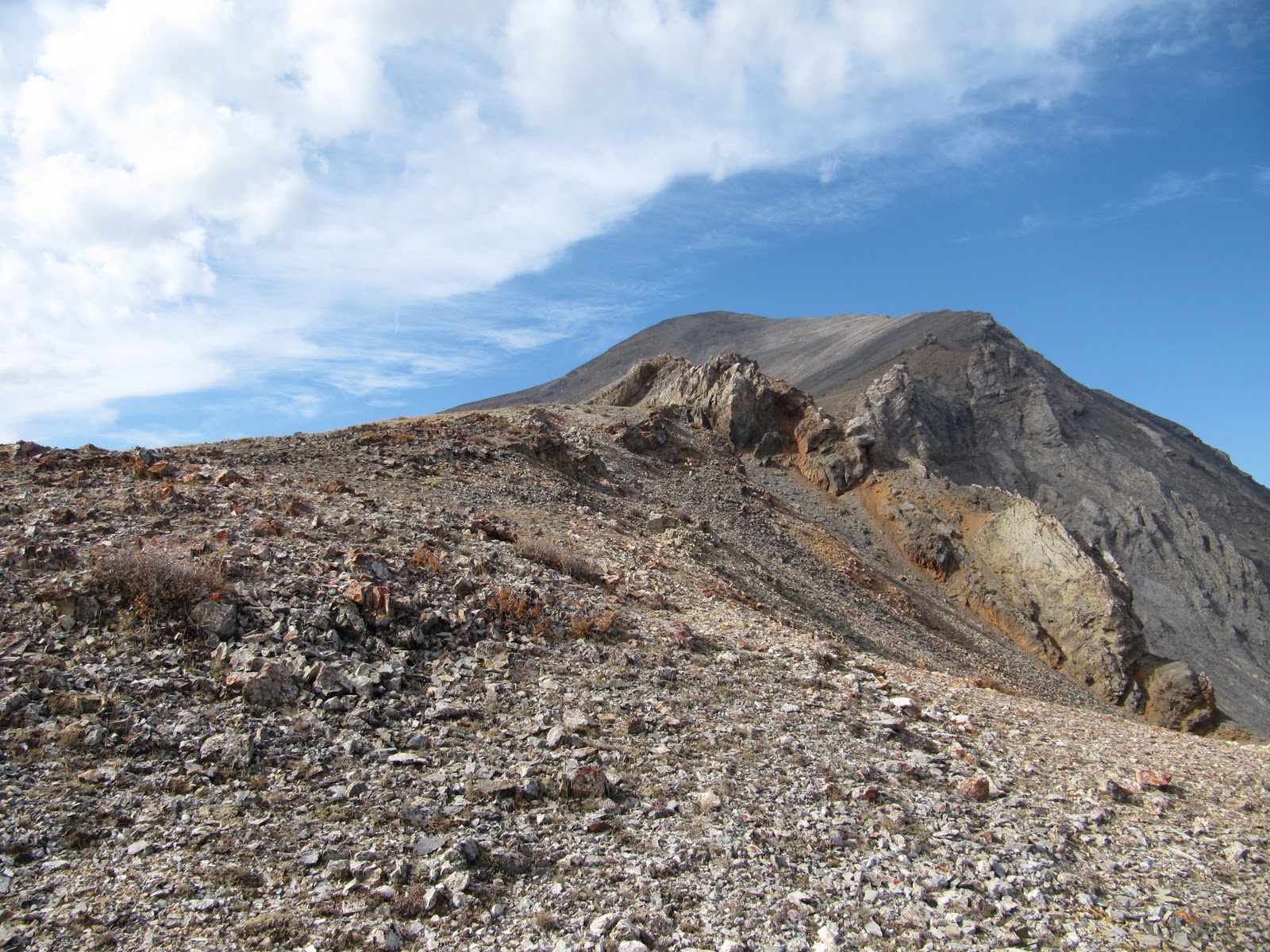
North Twin Peak (c), Red Cone Peak (l)
When Dan put the note out that he was looking for hiking partners for the weekend of the 20th, I was initially excited, then a little concerned. I had just come off of a foiled Buck Mountain (Tetons) attempt and was really re-thinking my abilities. Buck Mt is third class, with some snow and an awkward, and draining, rock garden. I had gotten sick four times before reaching the saddle and then fell asleep at 10,400+ ft. Anyone who knows me knows that sleeping is something I never do in the mountains...I am too excited about being in the mountains to sleep. Apparently it just wasn't my day, but could I recover enough in barely a week to climb again?

I held out on a final decision until Thursday night when Dan put out a second note announcing that he, Zach and Tom Lopez, like "the" Tom Lopez, would be joining us to climb North Twin Peak, 11081 ft, in the Lost River Range (LRR) near Sunset Peak. Climbing with the IdahoSummits folk is a high priority on my list, but getting to climb with the man who wrote "the" book on Idaho climbing ...wow, priceless.

So with Steve's blessing to back out of our trip to City of Rocks with his friends, I did a little "wow I get to meet and climb with Tom" dance and then the furious packing, celiac-friendly carbo loading, and hydrating began.


View in the meadow.

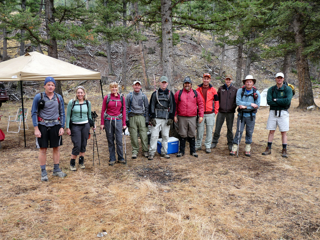
I met the guys in Arco Saturday morning, and then off we went. We drove high into Elbow Canyon, started hiking along the road into a meadow, and then made an error...we kept climbing too far into the canyon and missed our right fork. We regrouped, checked maps, and thought through our location. We then began traversing, and steeply ascending, to achieve a spot somewhere near treeline edge to get a visual on our actual location.

As we contoured the slope and came out of the trees, we saw we were now in the right fork of Elbow Canyon, and not far off of our location estimate...but we definitely were not on the ridge we thought we were going to ascend in the first place.


Dan in the canyon heading toward the saddle.
North Twin (l), Red Cone Peak (r).

Regardless, the canyon was gorgeous, offering great views all around and the scree was easy traveling. We climbed up a shoot to get out of the canyon and made our way up to the saddle approach with only a small section of loose side-hilling to deal with.

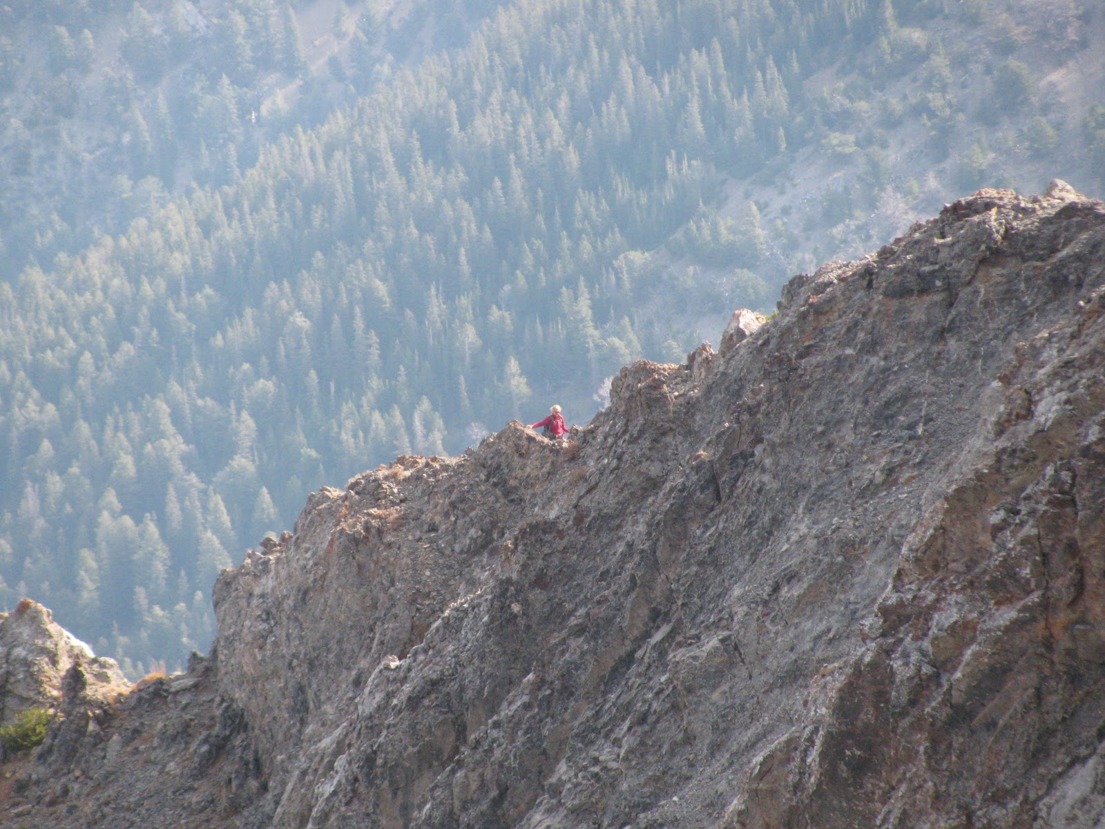
The saddle was beautiful with flowers in bloom, bees buzzing, and butterflies flitting everywhere. We then picked our summit approach line from the saddle and began up the ridge to North Twin. Zach and Dan were ahead of me and Tom followed shortly behind us.


View from the saddle. Sunset Peak to the left, Sunrise, right.
 As we looked up, at a point approximately 200 ft below the summit, a Rocky Mountain Big Horn sheep "scout" appeared above us on a tower and peered down at the curious-looking multicolor "sheep" below.

With my amazing zoom I managed a pretty descent photo of him. Shortly after, we saw the rest of his herd, or harem, up on the summit. They checked us out for a bit, but as I slowly and quietly climbed up higher to reach Zach and Dan, they scattered.

Rocky Mountain Big Horn sheep "scout."

The three of us continued on and worked our way through some ledges. In short order, we reached the summit with Tom following shortly after.

From the summit, after the requisite video, splattskis, summit (and other) photos, and snack break, we made a tentative plan to descend to the saddle, climb up to Point 10,286 and take the "right" ridge back down. Back at the saddle, the plan was still a "go" and within minutes we were at the top of Point 10,286. Here we found a Rick Baugher summit film canister with his note that indicated he was at the summit 18 years ago. We also learned the peak's name was Red Cone Peak, a to-a-tee descripter. We signed his summit note and then surveyed our descent options.


Splattski, summit Red Cone Peak,
N. Twin in the background. Zach, Dan, Tom and Margo.

It appeared that after a steep pitch immediately off of the summit, to the east, that travelling would be easier via the Cabin Fork Canyon rather than the ridge as we originally planned. So off we went. When we arrived at the canyon scree, some of it was easier travelling for awhile but then it turned into "pay attention" scree. Regardless, we all made it back down into the forest, into the meadow, and back to the car without incident.

On the drive back out of Elbow Canyon we startled up a black bear that, quicker than we could grab phones or cameras to document it, hauled up a rock face. A reminder to folks in the LRRs...that there are bear out there...best enjoyed at distance.

After a long day of climbing in the LRR, the obvious option for dinner was Pickles Place in Arco. :-)  My GPS battery died, so here is the route I estimated off of the points I did capture...mapped it in Google Earth.

Route in relief.
It was a great day in the LLRs, made better with the company of Idaho Summit folk and the opportunity to meet the author of my Idaho climbing bible.  Thanks everyone for letting SummitGirl join you. Climb On!

Sunday, August 7, 2011

#111 Bald Mountain


One of the stellar views from hiking Baldy

Bald Mountain Trail
I must have had a pretty stupefied look on my face when she asked, “Margo, do you want to do a hike up on Baldy (i.e., Bald Mountain) with me in the morning”?  Not hours before I had just returned from my solo ascent of Grays Peak in the Pioneer Mountain Range of Idaho. Don’t get me wrong, I’m all up for mountains...the number in the title attests to that fact. And Grays was a respectable near 4,000 ft gain over 7 miles, so I am no slouch. But, frankly, I am of a certain age, where any summit is something to celebrate…just after a few days, not hours, of recovery. So two in a row...ahhhh, I don't know. “We don’t have to go to the top, we’ll just go to the gondola and ride down,” she added. “Well, how long will it take?” I asked. “About 2 hours,” she stated. Well, I don’t have any blisters, no cuts, no injuries from Grays…just really, really sore muscles. Okay, well this might help with recovery. “Ok, sure.”  So at 8:00 a.m. we are off to Baldy or Sun Valley Ski Area, as most folks know it, to head off on a 2.5 mile hike of less than 1.5K vertical. According to SummitPost,

"Bald Mountain...is home not only to North America's first ski resort, but also includes exciting hiking terrain along with unbelievable scenery."
I've been skiing here for years, but really hadn't considering hiking it before. So we are off on our beautiful, leisurely hike, and then something happens to me.  
Carol leads
When we reach the “decision” point, it’s only a mere 2.5 more miles to the top…3,000 ft vertical total. And I can’t help myself…how can I be this close and not go to the summit? “I think we should go to the summit,” I announce. Well alright then. And we continue on. Past wildflowers, ski towers, memorials to loved ones (really...it's a great idea), and beautiful healthy trees.  We climb gently ever higher and make the summit 10 minutes ahead of pace.   
An example view.


But then I notice...we're at the "ski" top...not the summit. "I need to keep going, I will only be a few minutes." Neither Carol nor I had brought anything other than water. After all, we were hiking for 2 hours...that's it. "I really need to get something to eat, and I've been to the top oodles of times," the former Sun Valley ski patroller says. "Absolutely." So we decide that she will go down and I will go up and we'll rendezvous for coffee at the lodge. 

Splattski
So I head up a fraction of a mile and a few feet more. From the top where there is an old lookout, I get views of yesterday's peaks from the west and can see my yesterday, Grays Peak, summit.  I photograph a few peaks of possible future interest and head down.

The Pioneers famous threesome
So this is the best part. If you hike up, you can ride down for free. First the chair lift and then the gondola. It was great. No stress on the knees...wonderful!! ...And it still counts as a peak. For now, I have been down numerous times, strapped to boards, and up the mountain once. It counts. Yeh, and it's all good.

No GPS, no stats. It was only supposed to be a little hike...What I do know is that turned out to be 5 miles, 3,000 ft, another bagged peak, and a fun time with one of my favorite friends. What an awesome weekend!!    
If you haven't considered it before, add hiking (or mountain biking) on Bald Mountain and a latte at the lodge to your bucket list.  
Chairlift Down
 
Gondola Down


Peak #110 Grays Peak, Solo #2


Grays Peak from 9200ish feet.
I have kept this peak at the top of my list for a solo outing and this was the weekend to go after it.  From SummitPost, "Grays Peak is a large hulking summit that stands out from the main crest of the Pioneer Mountains like a soar thumb. Although not as high nor rugged as its Pioneer counterparts, Grays Peak is still an attractive cone-shaped peak that is especially beautiful in winter."

I had checked into Grays in 2009 after my first solo. The folks on the Idaho Summits board recommended it for its proximity to the road (I drive a Nissan...not an off-road friendly vehicle), straightforward approach, and at class II/III, depending on conditions, was within my abilities, especially as a solo.
"Hal" at the trail head.

I decided to take the west ridge approach both ways, thinking it was easiest but noted that it would be relatively easy to bushwhack down to the Federal Gulch trail should I need to get off of the ridge. I took my GPS, with an estimated approach route, and unlike my first solo, a hard copy topo and a trip report.

I left Friday afternoon to stay with friends in Hailey and left at 6:45 a.m. to reach the trail head for a reasonably early start. According to my beta, it would be 5 miles and 4500 feet.
Heading to the high point at 9200ish ft.

When I reached the summit in almost exactly 4 hours, I was pretty stoked and in a little disbelief. After all, I got wrapped around a couple rock outcrops at lower elevations that ate up some time and I took a number of micro-breaks (stop for a moment until your breathing stops racing) when I was climbing above timberline.
View from 9200 ft
So, my ascent time seemed a little good to be true, but overall I felt pretty good, so I guess it was possible.

While on the summit I noticed weather building to the west and heading my way. Nothing too immediate, but sure enough to get a move on. So after the requisite snack break, 360 photos, video and Splattski, I was off.

Splattski!!
I made the decision because of the weather that staying on the ridge may not be a good idea. When I spotted the lower trail I bushwhacked a rib down toward it and followed the trail until it tied into the Federal Gulch trail.

Feetski!!
Once on the lower trail, I took my time to "smell the roses" as it were, or in my case, photograph butterflies. Where the trail came near the stream it was flooded so I spent some time trail- and vegetation-clump hoping to stay dry. The vegetation is some sections was SOOO tall that I couldn't see the trail in front of me, or under my feet, so I proceeded by "feet feel." A few stream crossings later, I was back at the car and then the shower started...perfect timing.

Bushwacking to the Federal Gulch Trail.
It took me 6 hours for the entire trip, including breaks. According to my GPS, total elevation was 3760 ft, and 7 miles long. Even though it wasn't as much elevation as I expected, I moved along quite well considering. I saw NO ONE, I heard nothing other than the sounds of nature. I left no trace. Thank you Sawtooth National Forest, Ketchum Ranger District for the non-motorized wilderness experience and for accurate signage. Thank you IdahoSummits Board, as always, for your knowledge and encouragement and friendship. Thank you family and friends for your support.
You can't buy more nature...only preserve, protect and enjoy it!
On may way out I stopped by the Hyndman Trail head just to, you know, look around...like at Cobb and other ideas.
:-)

My Route.


#86/109 Garns Mountain

Steve ascending the upper snowfield, Garns in view.

Garns Mountain, in the Big Hole Mountains, was Steve's suggestion for a peak near his place in Driggs Idaho. The plan was to ascend via South Horseshoe. This particular trail will take you right to the summit of Garns Mountain and out the opposite side of the Big Hole range should you chose to arrange a shuttle and through hike. Our plan was just out, up, and back. Usually in July you can get into most back country areas in the Teton Range, but this past winter and spring the range has been hammered again and again with snowfall. It will be well into August until some areas are easily accessible.
The Tetons from the summit of Garns

But today (7/9/2011) was a beautiful day in the Big Holes, and except for some snow patches, was passable, albeit rather wet and boggy in places. Correspondingly, every shady spot along the way was ripe with mosquitoes, so it kept us moving at a steady pace.

Looking over at the Tetons on the ascent.

We were passed by a number of dirt bikers and a couple mountain bikers on our ascent. At one point we chatted with a few taking a break. "I see you're doing this the old-fashioned way," one commented. "Where's your bike"? We laughed and admitted our old school method was by choice. We picked up some beta and moved on. They soon passed us, but snow turned them around not long after. Of course, our "old-fashioned way" laughs at snow. When we reached the summit, we overheard a cyclist that had come up from the opposite side comment that "I've been coming up here each year for 40 years and I've never seen snow up here this late."
Piney Peak from the summit.

We took a break, had a snack, and watched chipmunks beg from us while one even went so far as to taste Steve's pack strap until we shooed it off.

Me thinks pack straps are tasty treats!

We were really tired when we reached the car, and no wonder...15 miles round trip for 2500 vertical. Still a wonderful outing! More information about Garns Mountain can be found at SummitPost.

Sunday, May 1, 2011

# 85/107 Peak 10941 - Idaho Summits Spring Outing 2011

Margo and Cerro Ciento ridgeline (back)


The 2011 mountaineering season started out with #84, Camelback Mountain, a local peak outside of Pocatello. I had a rough winter 2010 physically. Seemed that everything broke down after the great mountain bike wreck of summer 2010. After a very difficult ascent of Camelback, I went back to the doctor and made another run at physical therapy. At the same time, I met this great guy, Steve, who got me out skate skiing about every weekend from the end of January through the begining of April. Between PT and Steve, the Idaho Summits Spring Outing came back on my radar. So I brought Steve along to meet a few of my climbing friends....

Peak 10941 was chosen after a lot of consternation over the initial choice of King Mountain in the Lost Rivers, a peak I had already done and was non-motivated to do again. Weather and snow stability conditions caused, thankfully, a change of location to this lovely little gem in the Boulder Mountains outside of Ketchum, Idaho. A bonus of the whole deal was that Idaho Summits Dan had rented his company's condo for us; so we left behind the camp gear and camp food and enjoyed comfy beds and good quality cuisine in Hailey. I was first to vote for Thai food because rice noodles (which are gluten free/Celiac friendly) carry more carbs then regular noodles...little known fact. So it was Pad Thai for dinner.

We enjoyed a leisurely 8:25 a.m. start at the trail head for a nine-person assault on the peak. Half the group planned to hike entirely and the other half would be descending on skis. Conditions were overcast when we started out but close to treeline a beautiful day burst into bloom. We ascended steadily without incident...just a few little weird steps here and there. At the high ridge traverse before the summit I followed Dan's decision to switch from snowshoes to crampons. Somehow I neglected to take a summit video or a SummitGirl photo but I did put a few
photos of the day together to music.

Of the nine, Alex, Dave, Dan and I climbed and descended the peak in snowshoes/crampons. John, Dylan and Steve skinned/cramponed up and skied down. Jacob booted up, crossed over and bagged Cerro Ciento before hiking and glissading down, and Nathan, bagged 10941, Cerro Ciento, and Easley Peak before skiing down. Skiers (who had met Nate on his descent) beat the climbers down by 20-30 minutes, and Jake pulled in about 5 minutes after the climbers.

Trip Stats
Mileage: 7.1 miles
Elevation Gain: 3800 ft
Time: 7:30 hours
Class 2+
Partners: Dan, Dave and Alex P., John and Dylan F., Steve, Jacob, Nathan.

Partner Trip Reports:
Dan Robbins:
Idaho Summits
John and Dylan Fagden:
Fagden's Adventures

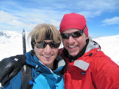
Margo & Steve, 4/29/2011


Peak 10941 brings my unique peak total to 85. Multiple ascents of a few of these peaks bring my overall count to 97 and then I reach two entries in my spreadsheet of "numerous ascents," Carbonate Peak in Hailey and Bonneville Peak in Inkom. My guess for those is probably 5-6 each...so...instead of continuing to say I probably have about 100 peaks, I am conservatively taking my 107 total forward into Summer 2011. My next summit will start at number 108. So...wanna join me on a little hike?